Northstar Autonomous Navigation System

Enabling safe autonomous navigation through challenging environments.

What is Northstar?

Northstar is a multi-platform, multi-domain modular autonomy stack that runs on-platform to provide full platform motion planning, control and dynamic collision avoidance.

It provides full motion planning and considers the current environmental conditions (wind, tidal stream) and platform characteristics to provide assured and deliverable pathing for a platform.

Benefits that Northstar brings to autonomous systems:

Uncrewed vehicle installed with Northstar
Ready for action
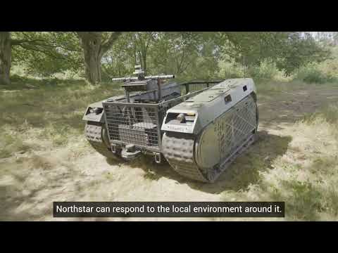
Northstar is pre-loaded with any available mapping & forecast data (e.g. Digital Terrain Elevation Data, s57 charts, bathymetry, environmental data) and the behavioural characteristics of the chosen platform. From this starting point, the user can plan missions by selecting time and location-based goals for specific platforms to perform.
Titan autonomous vehicle driving with Northstar
Perception of operational environment
Once deployed, Northstar uses sensors on board the platform to build a virtual picture of its local environment. Static and dynamic objects can be located and, if necessary, avoided. Users can also define mission objectives — such as a risk or no-go areas, or the weighting of factors that are to be optimised.
Mapping shown on Northstar interface
Simple interface
Northstar provides a simple software interface for the planning and monitoring of missions that utilises standard hydrographic and bathymetry charts. Where multiple platforms work collaboratively on a single network, a single User can control multiple platforms.
Northstar is able to control the vessel to perform a number of different Missions or Goals, including but not limited to:
  • Transit to user specified mission points, at a user specific time or given speed (or without constraint)
  • Track and rendezvous with static vessels (using radar/AIS) or infrastructure (based on GPS location).
  • Track and rendezvous with vessels underway using Radar/AIS
  • Shadow or Follow identified object (e.g. radar track) or another Northstar enabled vessel
  • Has the ability to define “behavioural” waypoints, i.e. upon reaching this waypoint Northstar will “flip a switch” – this will allow End User systems or payloads to be initiated upon reaching a waypoint.

Watch QinetiQ Programme Manager, Laura Law, demonstrate Northstar's capabilities:

Northstar will operate in GPS Degraded and Denied Environments, although accuracy of location will be degraded dependent upon the sensors fitted.


Related services and products